Thales & Cassidian Win IGN Contract
28.11.2011 Europe
The French geographic Institute IGN (Institut Géographique National), acting as the contracting authority on behalf of the Direction Générale de l'Armement (DGA) of the French Ministry of Defense, has contracted Thales and Cassidian to carry out the second phase of the TopoBase Défense Operation.
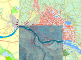
The goal of this operation is to produce data to feed into defense geographical databases. The contract confirms the position of the Thales-Cassidian partnership as a leader in the domain of very high-level geographical data.
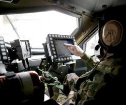
The preparation and conduct of military operations require the Armed Forces to be able to rely on a cartographic reference that is pertinent and accessible to everyone in order to achieve an accurate shared assessment of the operational situation.
For this reason IGN selected the Thales-Cassidian consortium with Thales acting as the prime contractor for the TopoBase Défense Operation. This operation is intended to set up an appropriate system for producing geographical data (e.g. vector databases, ortho-images, raster maps, etc.) to be fed into defense geographical databases.
The Thales-Cassidian consortium is responsible for the complete process, from receipt of requirements of the Armed Forces General Staff to quality control of the products. The process also includes drafting of specifications, definition of the production reference frame (procedures, tools, testing) and the management of subcontractors in order to guarantee the consistency and homogeneity of the totality of TopoBase Défense products.
The purpose of the contract, which has a duration of six years, is to supply the Armed Forces General Staff with digitized geographical data required for the operation of numerous weapon and information systems. The use of data from the TopoBase Défense Operation, which guarantees consistency of geometry and format, also contributes to system interoperability.
"I am very proud that the DGA has renewed its confidence in the Thales-Cassidian consortium after awarding us the first part of the TopoBase Défense Operation and the Deployable Geographic Modules project," commented Jean-Michel Lagarde, Thales Vice-President, in charge of Protection Systems.
"This success is attributable to the strong complementarity between the know-how of Thales and Cassidian, and to the creation of multiple partnerships with highly innovative European SMEs specialized in geomatics. A total of nearly 150 people are combining their skills to ensure the success of this operation."
"Global information control and knowledge of the terrain constitute a crucial force multiplier for the General Staff. That is why our company is particularly proud of the confidence displayed by the IGN through its selection," added Franck Calvet, Vice-President of "Integrated Systems" at Cassidian.
The first phase of the TopoBase Défense Operation was awarded by the DGA to the Thales-Cassidian consortium in 2005 under the 3D digital geographical data (DNG3D) program.
Previous PostDefense Expenditure Top Priority For Poland
Latest news
Latest events
Doha International Maritime Defence Exhibition & Conference (DIMDEX 2026)
19 - 22 Jan 2026Doha - QatarUMEX – SimTEX
20 - 22 Jan 2026ADNEC Centre Abu Dhabi, - United Arab EmiratesWorld Defense Show (WDS) 2026
08 - 12 Feb 2026Riyadh - Saudi ArabiaSAHA EXPO International Defence & Aerospace Exhibition
05 - 09 May 2026İstanbul Expo Center - Turkey

